|
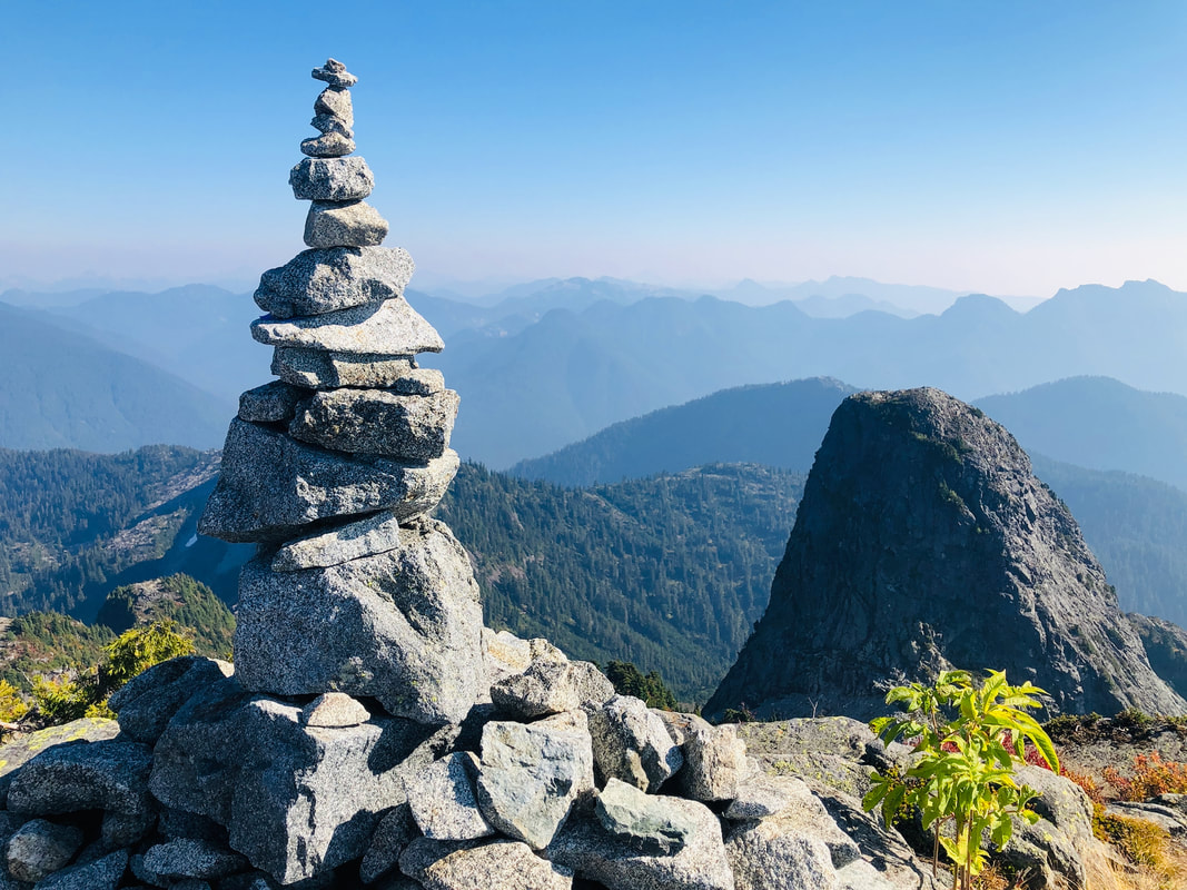
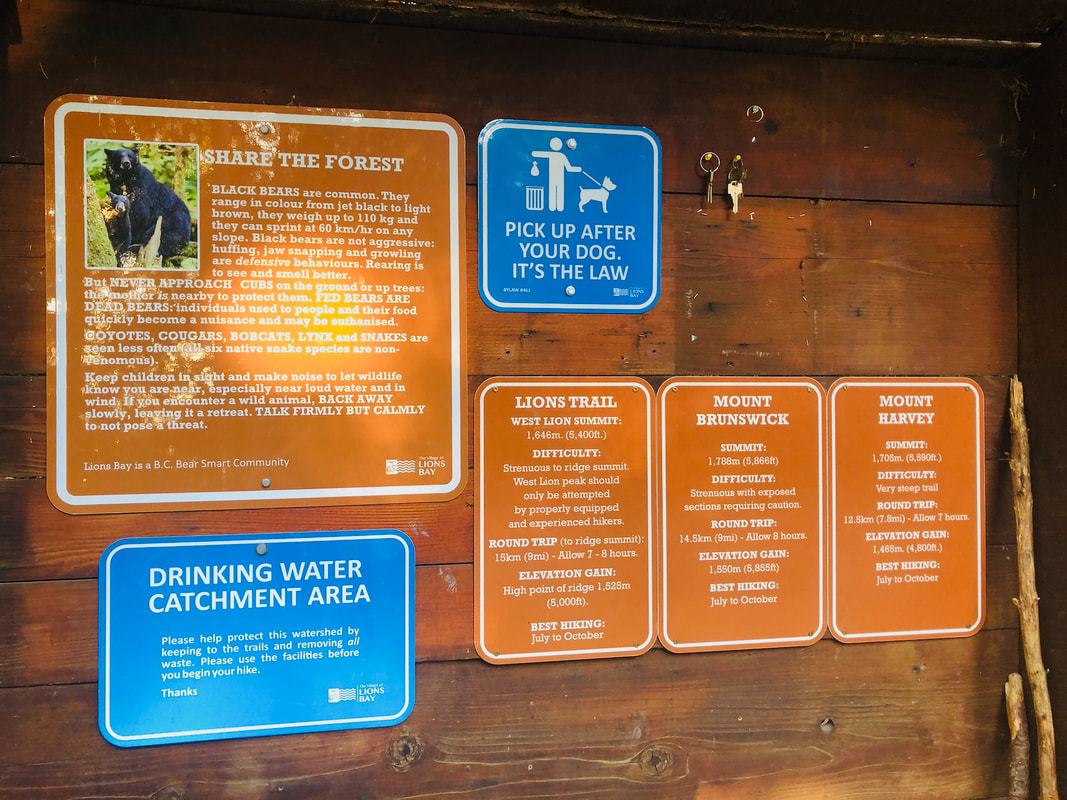
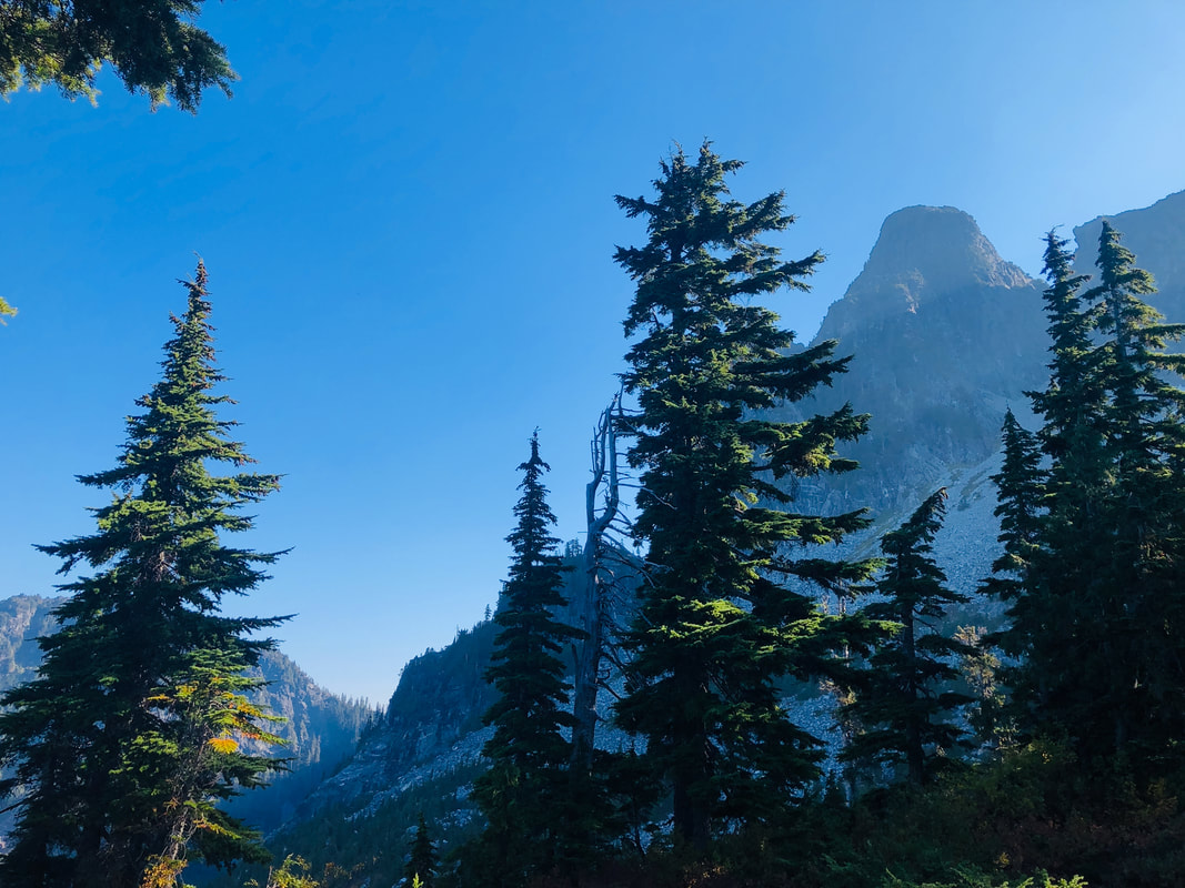
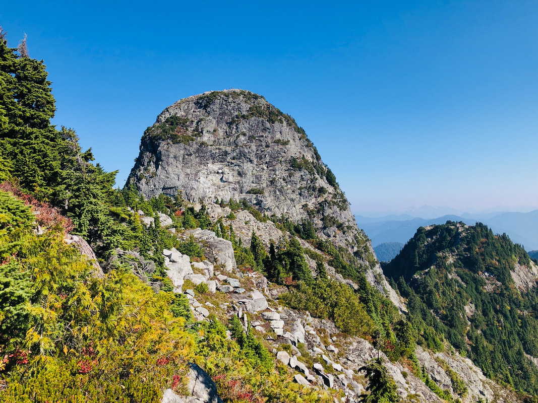
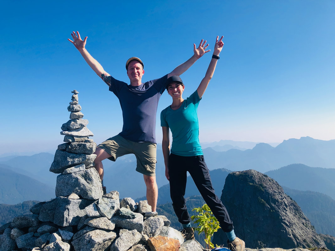
The mountains overlooking Vancouver have several rockstars. There are the three ski resorts, the gondolas of Grouse, and the choppy crest of Crown. Perhaps the most distinctive peaks are The Lions, named in the 1880s because they resemble two sleeping lions (and because nobody back then deferred to Indigenous names). The East and West Lion peaks (reaching 5269ft and 5400ft respectively) inspired the BC Lions football team, Lions Gate Bridge, Lions Gate Hospital, and Lions Gate Entertainment. They also inspire ambitious hikers to brave a knee-punishing ascent with a memorable day-hike or overnight trek, complete with a challenging summit free climb. I am not an ambitious hiker, but conquering the Lions has been on my bucket list for years. This year, all my excuses finally ran out. Before we get to the hike, it’s important to recognize that these are not Lions at all, they’re actually twin sisters. According to the Squamish people, the Twin Sisters are markers of peace between the Squamish and Haida, formed by the Creator to honour a treaty, or as a result of twin Squamish sisters captured by a Haida raiding party. Dismissing Indigenous legends and name places to honour colonial heroes and symbols has fortunately run its course, so this blog post would like to acknowledge that it takes place on the unceeded territory of the Squamish people, and is grateful for the opportunity to visit the hallowed peaks that mean so much more than a great view and a hiking adventure. I’ll call them Lions moving forward, but continue to pay my respects to the Twin Sisters and their cultural legacy. There are two ways to hike the Lions. Park at Cypress Mountain Ski Resort and hike up and across the mountains, or park in Lions Bay and hike up… and up…and up. The Cypress route adds a few kilometres and requires some parking and driving coordination, especially if you’re descending on a one-way route through Lions Bay. The Lions Bay route requires a lucky parking spot in the few public spots available at the trail head, or get ready to add some asphalt road ascent to your journey. Be on the lookout for unimpressed NIMBY Lions Head neighbours who don’t appreciate hikers visiting their secluded mountain community. At least they didn’t seem to appreciate me, perhaps because I had arranged a parking pass and my Kia brought down property values for a day. Signs at the trail head to West Lion make no mistake what’s in store: Difficulty: Strenuous. Only be attempted by properly equipped and experienced hikers. The sign states it is 15km round-trip to the summit, with a hefty 1525m elevation gain. It suggests you budget an ambitious 7 to 8 hours. There are also bears in the area, along with cougars, bobcats, coyotes, lynx and even snakes (although the local snakes are harmless). As I started up the trail, encountering any wildlife would instantly become the least of my concern. Up we go. And up. And up. And up further still. Ah, what’s this? A flat section! Through fairy beds of green moss and lush tree tunnels, beautiful, I needed that welcome breather, and…. nope, it’s up again. And up, up, and up further still. Poles are essential, as are frequent water breaks (I slugged through 2.5 litres of water on my hike, and I don’t drink that much). Loose rocks are waiting to roll your ankle, and slippery roots waiting to trip you up. We cross a bridge over a fetching cascade, which invites a cool dip in the rock pools, but there’s no time to dally. It’s an unseasonal warm and dry October, which means a lovely cool temperature and few bugs, but also shorter days. We were on the trail by 7:45am. The parking lot, incidentally, was already full. The West Lions is a popular hike, and everyone I passed seemed in better physical and mental shape to do it. A group of bro’s (shirtless, tanned, bleached hair, ripped, backward baseball caps) were already on their descent. These are BC’s hiking equivalent to California’s surfing dudes. I encounter groups and couples, and a quick-footed solo teenage boy with parents that should be proud and worried. Up and up, over and up, until almost 4 hours in, we crest at a viewpoint and finally see the mighty Lions up close. Solid rock (hornblende diorite for you geologists), the two peaks are more imposing and intimidating when you stand beneath them, casting a shadow into the valley below. As we continue our ascent, the rocks become bigger and more challenging, remnants of several millennia of rockslides. Tears are flowing from my knees, and I’m cursing the weight of snacks I thought I’d need in my daypack. Finally, we reach a large outcrop where most sane people stop to enjoy the incredible 360-view of the Lions, the Howe Sound, and on a clear day, Vancouver far below. Most sane people will reach this point, say they’ve hiked the West Lion, and call it a day. The rest of us might continue on the 29-kilometre Howe Sound Crest Trail from Cypress Mountain to Porteau Cove, or decide it’s worth the risky free-climb up the rock to the West Lion summit. Cramping legs, blistered ankles, heavy breathing, no fitness whatsoever…of course I’m going for the top. Other than one handy rope to assist with a 5 metre drop at the start, there are no chain ladders or ropes. I had to navigate up and over sheer rock face, balancing on narrow ledges while desperately searching for rock holds, doing my best not to think about the 30m – 50m plummet below. Some hikers brought helmets and climbing shoes. I had a flask of rum. Remember: three points of contact! It’s been a while since a physical challenge intersected so concisely with my mental fear, and several times I paused to breathe, stay calm, and recollect myself in that special place we all visit sometimes. It doesn’t take very long to get to the summit, but after a challenging 5-hour ascent, it’s tough as hell. My thighs cramped up just in time to collapse in a heap by the West Lion’s rock cairn, the only sign that you are indeed, as high as you can go. Oh, and the sweeping, spectacular view that surrounds you. It’s almost enough to make me forget that I now have to scale down the dangerous rock, and then hike down a trail so steep it could snap a shock absorber. A few Band-aids, a swig of rum, some yummy sandwiches, painkillers, candy and nuts, and we’re on our way down. It’s always much quicker hiking down than up, but it’s also hell on your knees and tricky for your ankles. Yet with fine company, fine weather, and the intangible joy that accompanies any sense of accomplishment, we slowly made our way down to Lions Bay. You do not want to descend this trail in the dark, but we timed it perfectly, arriving at the parking lot at 5:45pm. With plenty of breaks and time to enjoy the views (and factoring the state of my fitness), it was a very long, 10-hour hike, and the second most challenging hike of my life (here’s looking at you West Coast Trail). It took a few days for me to stop walking like a stepped-on spider, and yes, it definitely would have helped to have prepared with more than just a few games of pickleball. There’s plenty of reviews of the West Lion hike on various hiking sites, and yes, I can confirm the last scramble is as challenging as everyone says it is. Unless you’re that ten-year old girl who passed us on the way down, carrying her stuffy Snow Leopard. As I lay in bed that night groaning with stiffness, my wife asked me why on earth anybody would ever want to do this to themselves? My reply was simple: “Every time I see those Lions, I can think ‘I’ve been to the top of that!’ It’s a personal accomplishment that just keeps on giving.”
Special thanks to Jon, Revelie, Mike and Stephanie.
0 Comments
|
Greetings.
Please come in. Mahalo for removing your shoes. After many years running a behemoth of a blog called Modern Gonzo, I've decided to a: publish a book or eight, and b: make my stories more digestible, relevant, and deserving of your battered attention. Here you will find some of my adventures to over 100 countries, travel tips and advice, rantings, ravings, commentary, observations and ongoing adventures. Previously...
July 2024
Categories
All
|

 RSS Feed

